


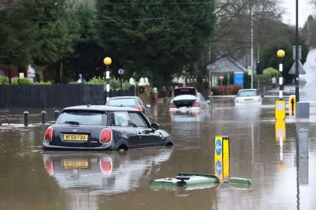
A new study led by the Environmental Change Institute (ECI) at the University of Oxford reveals that the biggest costs of flooding may not be road repairs, but the disruption it causes to everyday life. Using historical flood events from 1953 to 2024, researchers modelled how extreme floods could affect commuting across Great Britain, showing that the economic impact of delays, detours, and isolation can far exceed the cost of repairing damaged infrastructure.
Dr Yue Li, Postdoctoral Research Associate at ECI and lead author of the study, said:
Flood impacts emerge from interactions between hazard, network capacity, and human response — not infrastructure damage alone. Spatially coherent flood scenarios are essential for network-level stress testing, revealing how indirect damages propagate through connectivity and substantially alter system-wide performance. Evidence from historical GB flood events shows that the most severe disruptions are driven by large-scale connectivity loss rather than direct asset damage alone.”
The team combined national commuting data with detailed flood maps to simulate millions of daily journeys across the road network. The analysis highlights how major cities such as London, Manchester, Glasgow, and Cardiff rely on a limited number of key commuter routes — and how disruption to these corridors can ripple across the wider economy.
It also shows how different regions play distinct roles in the UK’s commuting system. Areas including Eastern England, the South East, and the East Midlands supply large numbers of workers, while urban centres draw them in — meaning even short-lived flooding can have far-reaching consequences.
The research, published open access in Transportation Research Part D: Transport and Environment, also identifies which types of roads are most vulnerable. Single-carriageway A roads and suburban bridges, often overlooked, emerge as critical weak points. Even minor flooding on these routes can lead to long detours, increased congestion, and significant knock-on costs for commuters and businesses.
The project was a collaboration between ECI researchers and software engineers — Dr Yue Li, Dr Raghav Pant, Professor Jim Hall, Tom Russell, and Fred Thomas, from the Oxford Programme for Sustainable Infrastructure Systems (OPSIS) — and external partners JBA Risk Management and JBA Trust. Industry partners provided key flood data and technical expertise, while the Oxford team led the modelling, analysis, and interpretation.
Dr Paul Young, Head of Science at JBA Risk Management, said:
This study shows the value of combining academic modelling with real-world data and applied risk expertise. Building on a long-standing research collaboration between JBA Trust and Oxford’s Environmental Change Institute since 2015, we’ve been able to explore how flood impacts propagate through infrastructure networks in ways that aren’t visible from asset-level analysis alone. While this is fundamentally a research advance, it also points towards more decision-relevant ways of understanding and managing risk in complex systems.”
By mapping both direct and indirect impacts of flooding, the study provides new insights to help governments, planners, and communities better protect the transport networks that keep the country moving — ensuring access to work, education, and essential services, even in extreme weather.
Read the full paper in Transportation Research Part D: Transport and Environment:
Stress-testing road network resilience using counterfactual flood events (1953–2024) in Great Britain