
A mapping system which allows the condition of habitats to be monitored and managed is being used by the Australian government to report on their biodiversity progress for the first time.
The Habitat Condition Assessment System (HCAS) was developed by a team of scientists in Australia including Dr Tom Harwood, Associate Director, Environmental Change Institute.
This year, the Australian Government Department of Climate Change, Energy, the Environment and Water (DCCEEE) have for the first time used HCAS and the National Connectivity Index which HCAS contributes to, to set benchmarks for measuring the biodiversity performance of the Department.
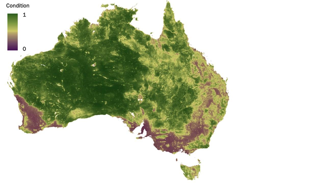
The HCAS approach breaks new ground and is the only system of its kind using remote sensing to consistently measure the condition of its habitats at regional, state, and national scales without comprehensive local, on-site assessments.
HCAS is a flexible platform that can continuously evolve as site data, satellite imagery, and statistical modelling methods advance. As a result, the HCAS has been incrementally improved in several progressive versions.
The next generation of HCAS (v3.0) is currently in development and has an anticipated launch date of mid-2024. Critically this will move beyond a dependence on MODIS satellite imagery as the data stream is being decommissioned., It will include extensive updates such as increasing the output resolution and improving condition estimate accuracy in riparian zones and wetland habitats. Dr Harwood is contracted to provide expert advice.
The research team says this new version will not only include substantial improvements, but also a clearer evaluation of its limitations and areas of uncertainty. Further enhancements will be identified to take advantage of new developments in site data, remote sensing and machine learning toward more 'real-time' mapping.
Dr Harwood, who is now based in the UK at the ECI, said he is using his knowledge from delivering HCAS and global condition for UN CBD indicators to develop fine resolution condition products for the UK for use by ECI colleagues.
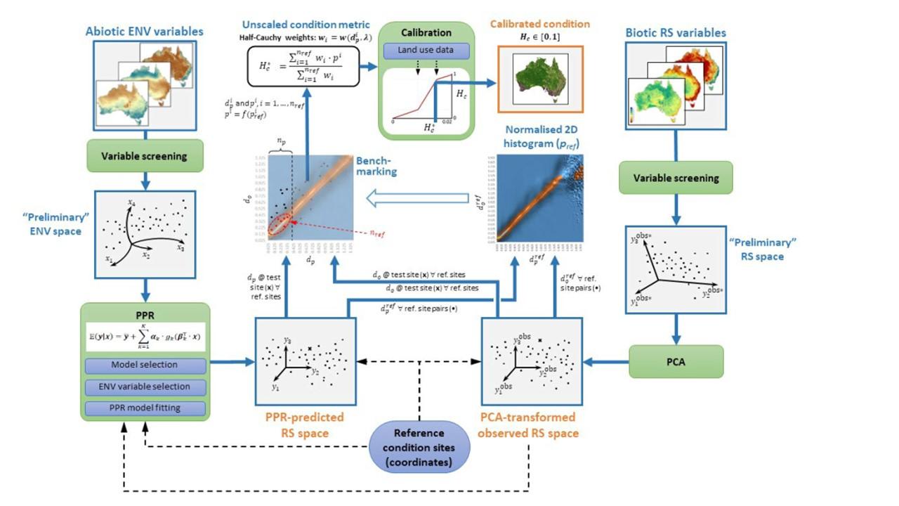
Using the remote sensing alongside spatial ecological modelling, and sparse data from on-site assessments, the researchers have been able to build a picture of what a particular area looks like, relative to the range of natural states it could potentially look like, and use this difference to comment on the quality of habitat. The system currently works at a 250m spatial resolution across the continent.
Dr Harwood said:
This system is based on the premise that habitat occurring at places with similar abiotic environmental conditions, such as soil, landform, and water availability, should look similar when viewed using remote sensing, averaged across seasons and years. Where two such places have markedly different remotely-sensed signals, this may indicate a difference in their condition for biodiversity.”
Government officials said they wanted to build a capacity to predict current habitat condition and report on likely trends across the continent to inform its interventions and reporting.
HCAS uses the scientists’ knowledge of ecosystem dynamics and an understanding of how ecosystems respond to anthropogenic disturbances.
The model uses multiple reference points and a scoring system to make predictions and comparisons.
Dr Harwood added: “We used general measures of condition which can be continuously applied across multiple habitats. A continuous measure of condition may be scored from 0 ‘degraded’ to 1 ‘natural’, recognising that at the degraded end, even highly modified systems may support some biodiversity, and that at the natural end, there will be very few, if any, examples of truly pristine sites, due to millennia of direct and indirect human influences.”
Since the system was first introduced it has regularly been updated and the mapping monitored for accuracy.